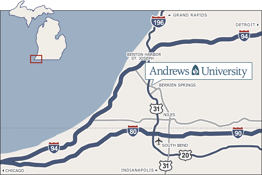
Getting to Andrews
| Related Links |
|---|
|
Airports Bus Stations Train Stations Transportation Dept. Time Zone Traveling Campus Map Student Visits Map |
We are located in rural southwestern Michigan and if you are within 300 miles of Andrews, the cheapest way to get here is by car. If you are coming from further away or would just prefer taking the bus, Greyhound serves the nearby town of Benton Harbor, just 12 miles from the campus. You can also take the train—the closest station with an Amtrak service is Niles, 15 minutes from campus.
If you are thinking about flying to Andrews, the closest airport is South Bend Regional Airport. Many students, friends and visitors of Andrews also fly into the Chicago O'Hare or Midway airport and then use public transport to the South Bend airport. You can find available options on the Southbend Airport website.
Driving Directions
| From the North and West | From the East | From the South |
|---|---|---|
|
|
|